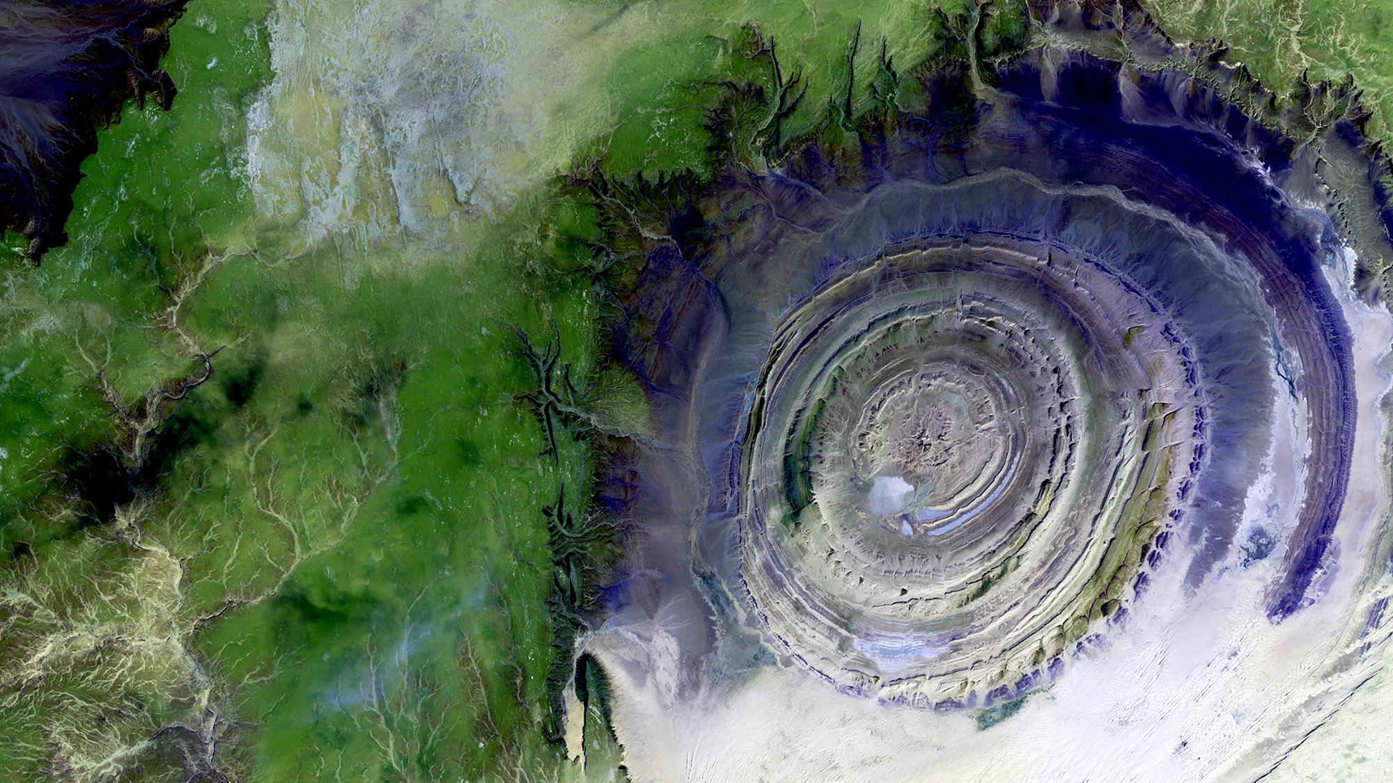
Sensores Ambientales
Fusión inteligente de datos de sensores de superficie satelitales e in situ para ayudar a comprender nuestro planeta cambiante
Mayo 2021 - Presente Python
scivision
Herramienta conectando a los desarrolladores de modelos de visión artificial con proveedores de datos de imágenes de diversos campos científicos
Mayo 2021 - Presente Python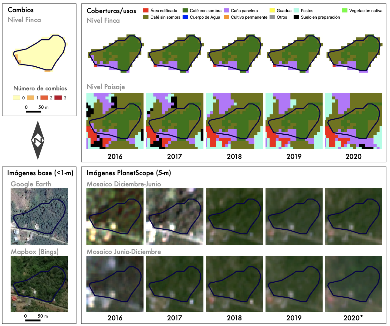
Sistemas de producción de café en Colombia
Desarrollo de una metodología para mapear anualmente los sistemas de producción de café, expuesto al sol y con sombrío en Colombia
Diciembre 2020 - Abril 2021 Python, JavaScript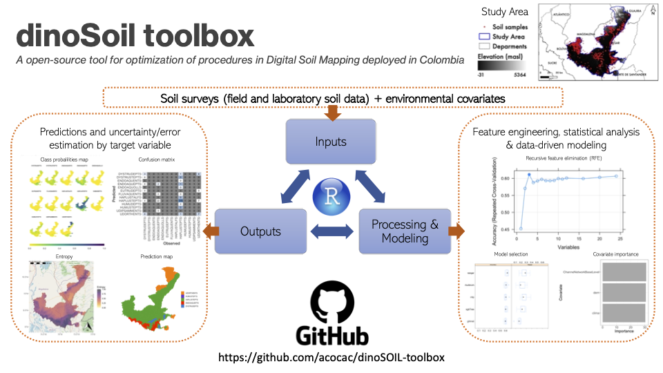
Mapeo Digital de Suelos en Colombia
Creación de una herramienta para optimizar los procesos de Mapeo Digital de Suelos a cargo del Instituto Geográfico Agustin Codazzi
Agosto 2020 - Diciembre 2020 R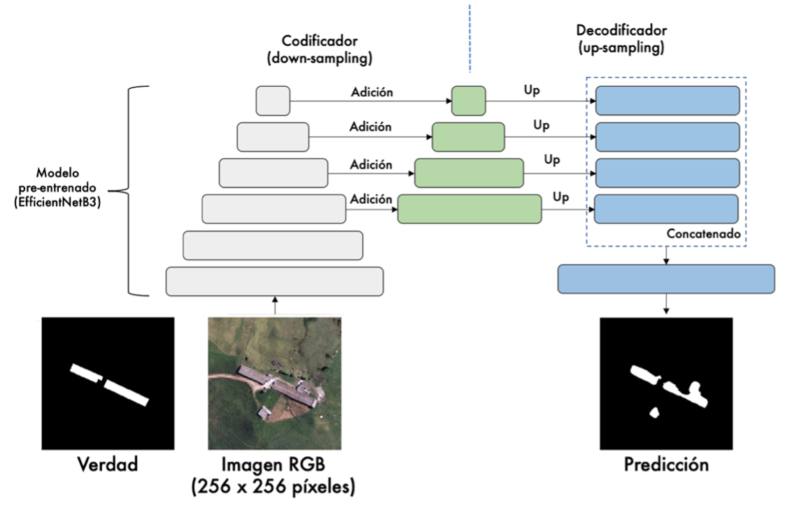
Detección cambios en construcciones rurales
Desarrollo de un prototipo de aplicación en Google Earth Engine (GEE) para la detección de cambios de construcciones en ámbitos rurales
Agosto 2020 - Diciembre 2020 Python, JavaScript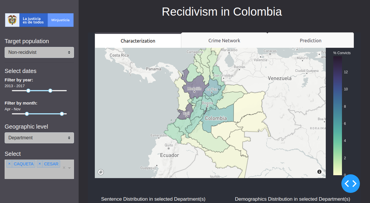
Predicción de la reincidencia en Colombia
Propuesta de un modelo predictivo basado en machine learning para detectar la reincidencia en el sistema penitenciario y carcelario colombiano
Mayo 2020 - Julio 2020 Python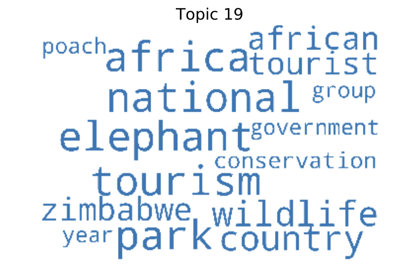
Minería de textos para el monitoreo ambiental
Uso de procesamiento del lenguaje natural y otras técnicas de minería de textos para el monitoreo inteligente de zonas de conservación
Diciembre 2019 Python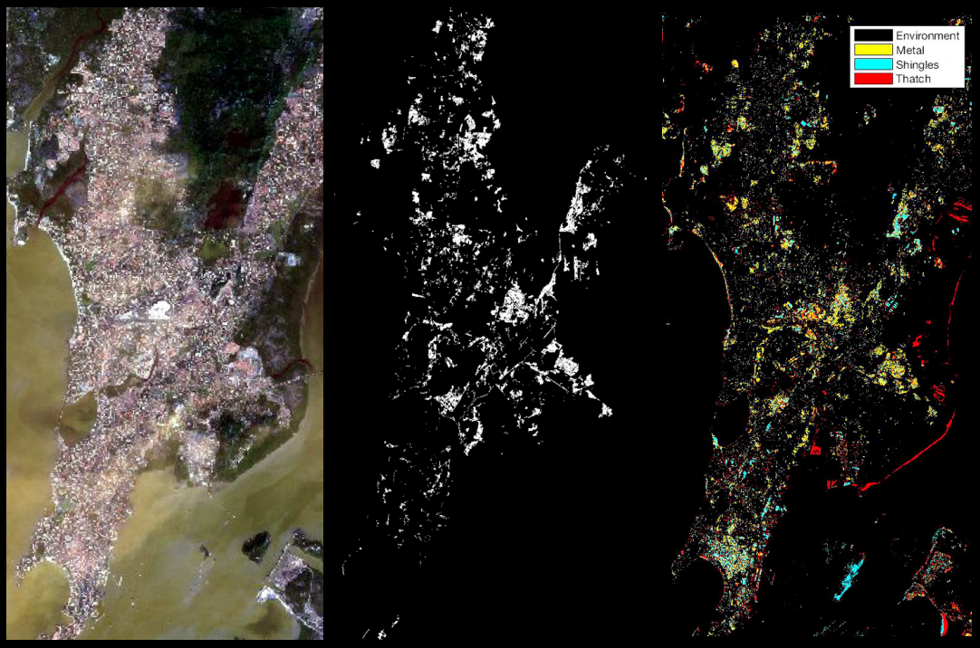
Mapeo de asentamientos ilegales
Desarrollo de una metodología para el mapeo de asentamientos ilegales como parte del programa Frontier Development Lab (FDL)
Junio 2018 - Agosto 2018 Python
Coberturas y uso del suelo post-deforestación
Investigación doctoral en King's College London enfocada al estudio de la trayectorias de cambios de coberturas y uso de suelo en áreas deforestadas
Abril 2016 - Marzo 2020 Python, R, JavaScript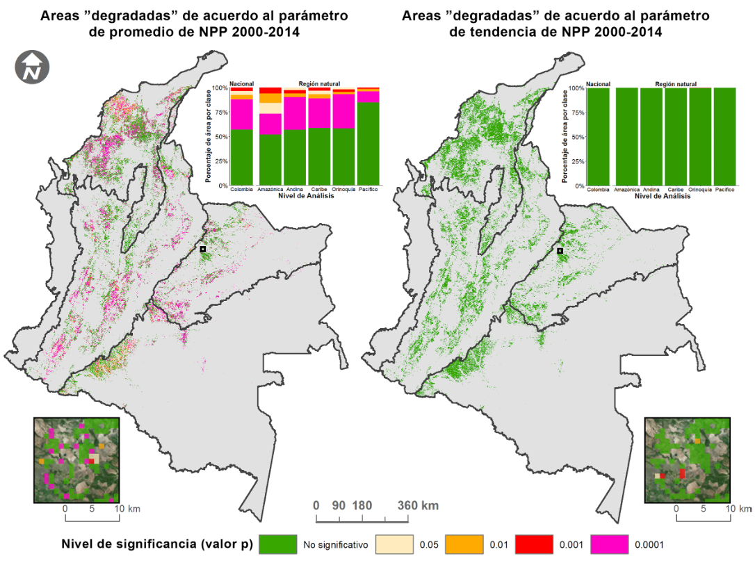
Degradación de las pasturas en Colombia
Evaluación de metodologías de escala nacional a local para determinar el estado de degradación de pasturas en Colombia
Octubre 2015 - Diciembre 2015 Python, R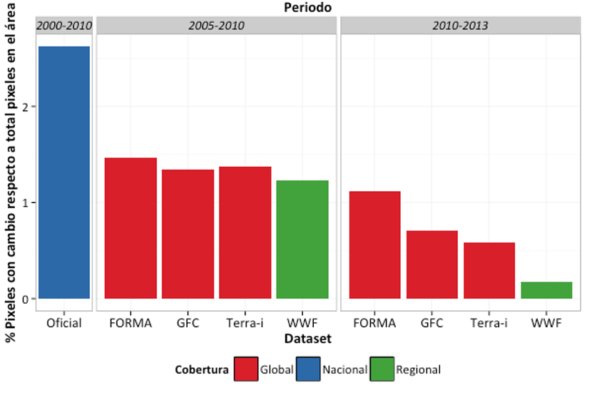
Productos de deforestación en el Amazonas
Comparación de un producto de la deforestación generado por WWF-Colombia a partir de datos satelitales MODIS sobre el bioma Amázonico
Octubre 2015 R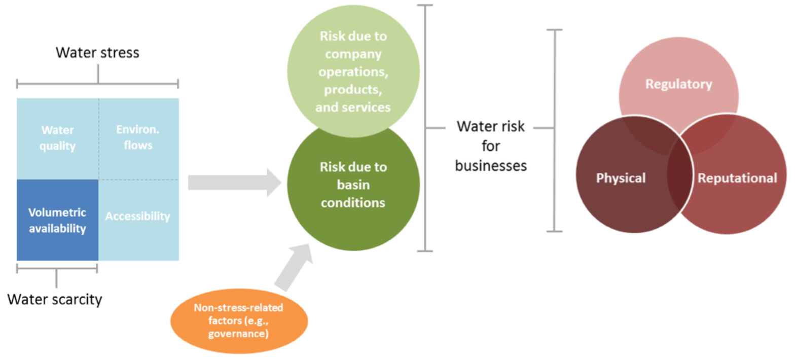
Seguridad hídrica del Amazonas
Compilación de los conceptos y herramientas para cuantificar la seguridad hídrica con enfoque en los países del bioma Amázonico
Septiembre 2014 - Agosto 2015 N/A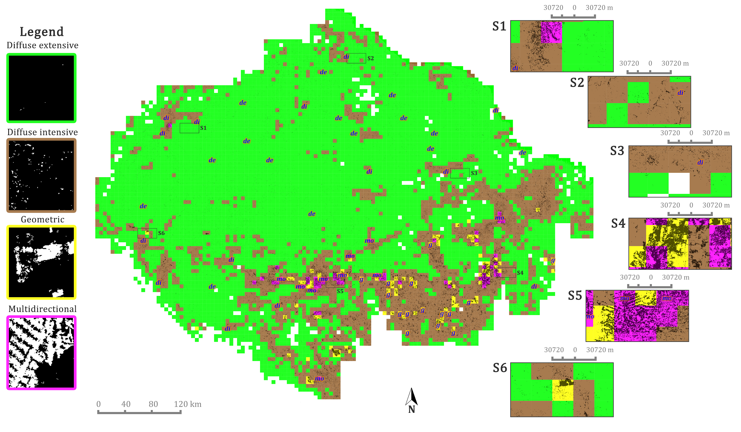
Patrones espaciales de la deforestación
Investigación de maestria en King's College London enfocada a una herramienta para el mapeo de los patrones espaciales de la deforestación
Septiembre 2014 - Agosto 2015 R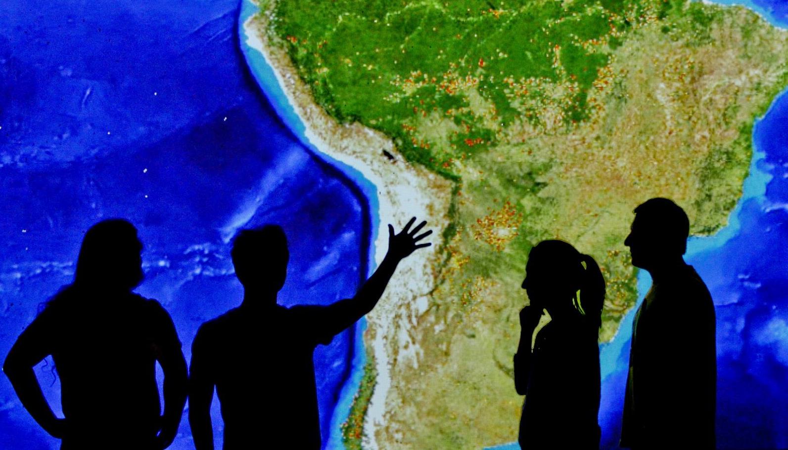
Terra-i, monitoreo de la deforestación
Herramienta para el monitoreo del cambio de habitat con enfoque operacional en América Latina y el Caribe
Mayo 2011 - Septiembre 2014 Python, R, Java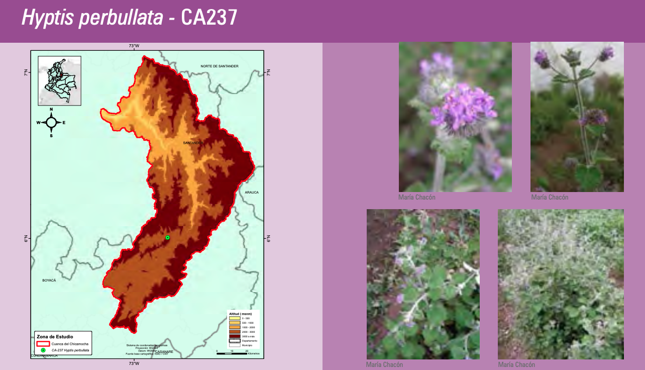
Cartografía de especies vegetales aromáticas
Generación de los mapas del catálogo Especies vegetales aromáticas de la Provincia de Sumapaz y la cuenca del río Chicamocha en Colombia
Abril 2011 - Mayo 2011 Python