Non-profit
The Alan Turing Institute
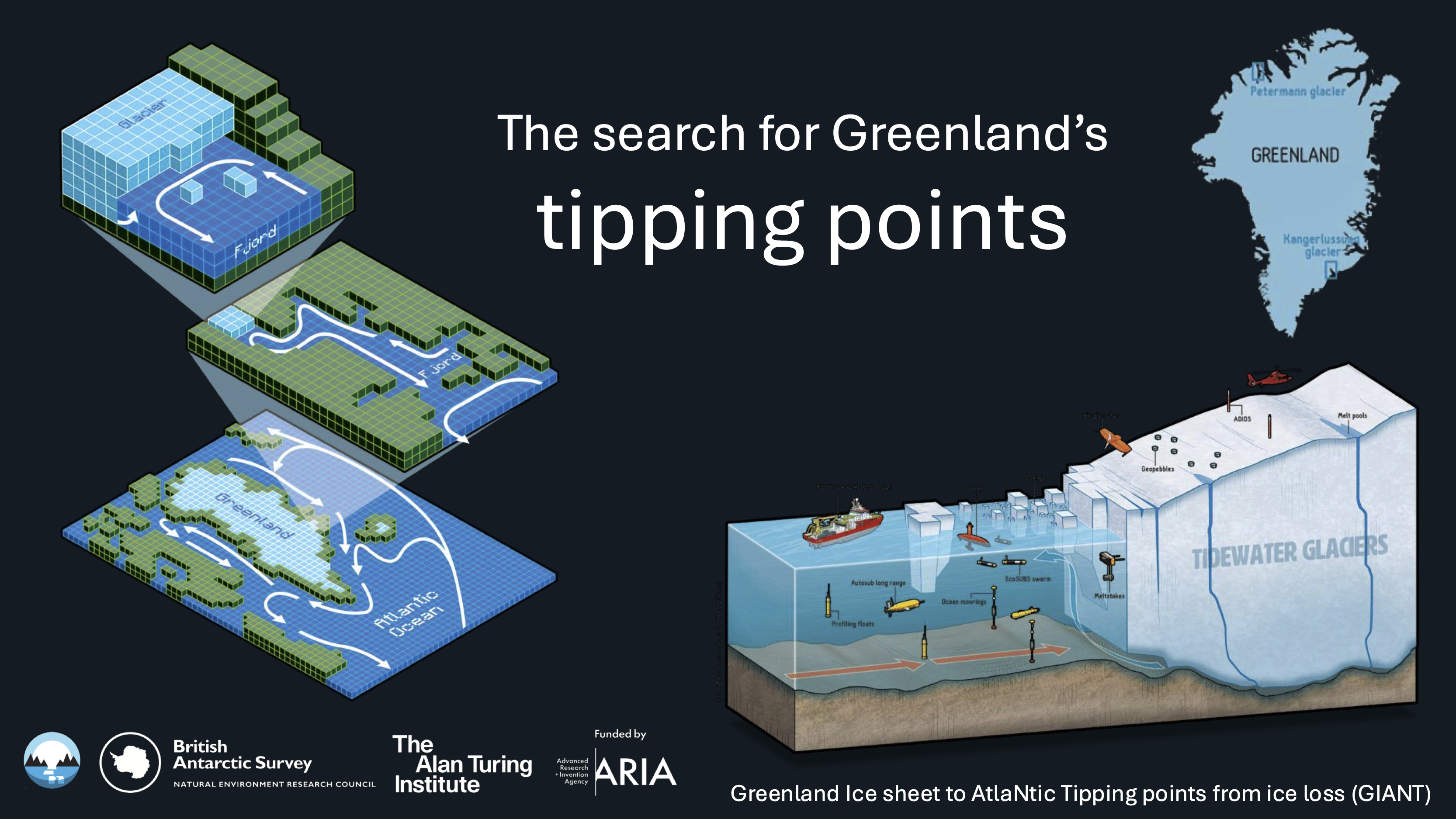
GIANT, a £20m UK-led scientific initiative focused on understanding how melting glaciers in Greenland affect global ocean circulation and climate.
Developing intelligent sensor placement to optimise tipping point monitoring in Greenland.
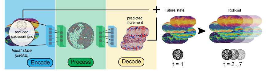
FastNet is a data-driven medium-range numerical weather prediction model developed jointly by the UK Met Office and the Alan Turing Institute.
Contributed to the development and maintenance of MLOps workflows (data preparation, training, validation, logging) for delivering the FastNet v1.1 model, which is publicly shared in Hugging Face.
Researcher of a work stream of the UKRI-ESPRC £5m funding for the Turing’s Environment and Sustainability Grand Challenge focused on developing DeepSensor, an open-source toolkit for environmental modelling using Neural Processes.
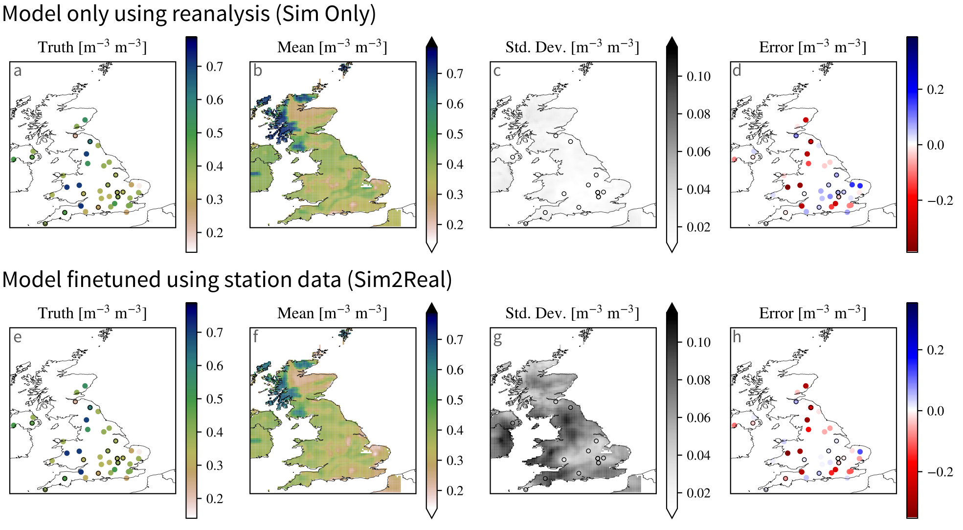
Evaluated the impact of sim2real methods to handle data scarcity for UK soil moisture modelling.
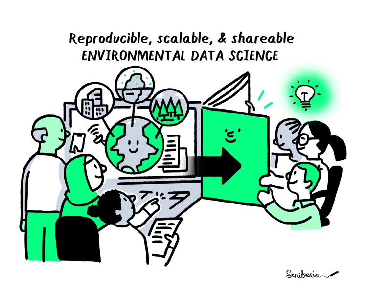
PI of the workstream “Foster an open international environmental data science community” of the UKRI-ESPRC £5m funding for the Turing’s Environment and Sustainability Grand Challenge.
Led the publication of a new version using Jupyter Book V2 of the Environmental Data Science Book.
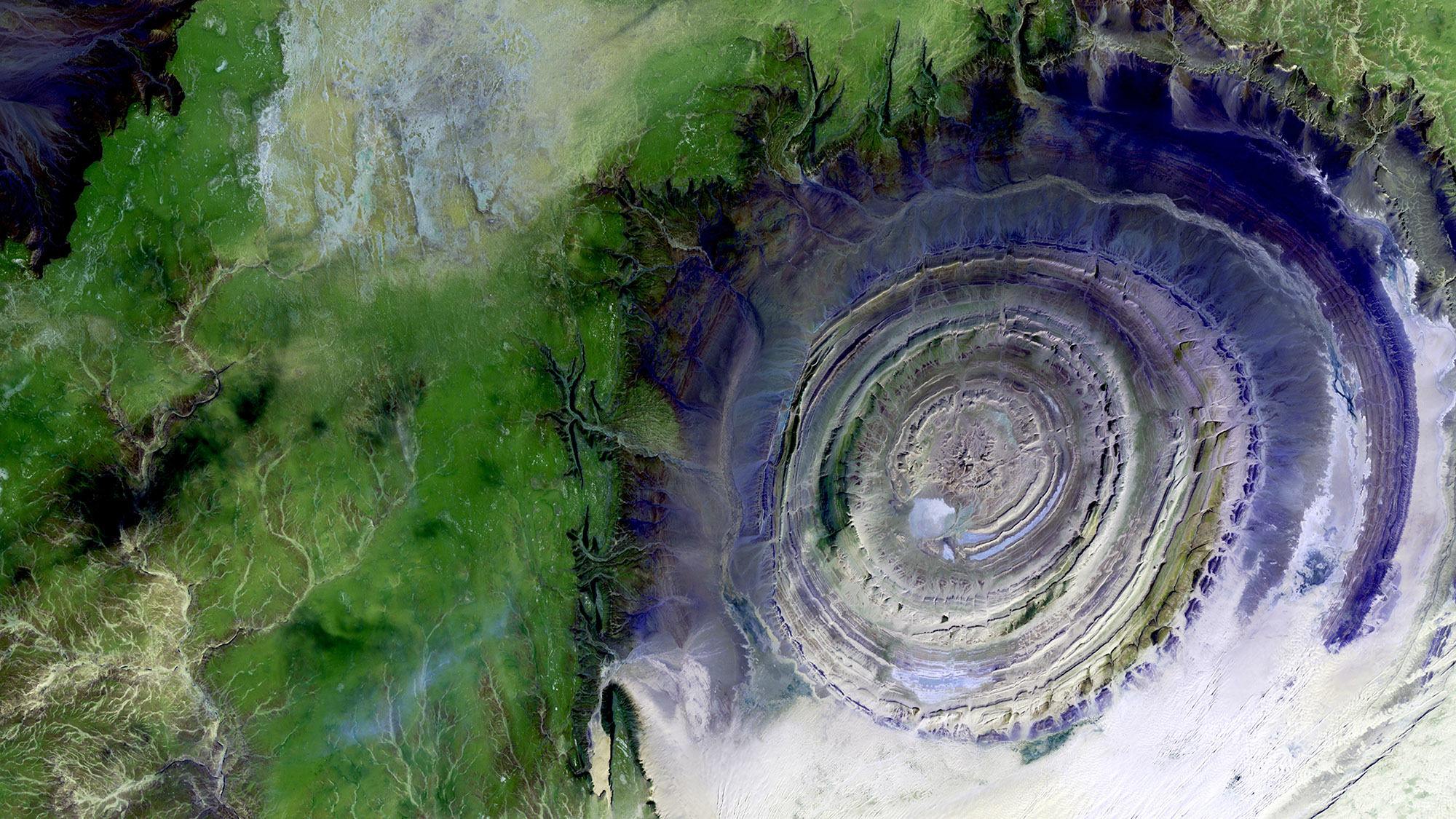
Intelligent fusion of surface, satellite and in-situ sensor data to help understand our changing planet. A probabilistic-modelling framework developed in collaboration with the British Antarctic Survey, the Met Office and UKCEH.
Produced a high-resolution dataset of UK soil moisture by fusing reanalysis and in-situ data.

An open-source tool connecting computer-vision model developers with providers of image data across a range of scientific fields.
Prepared datasets and models in environmental research for the scivision catalogue.
Solidaridad
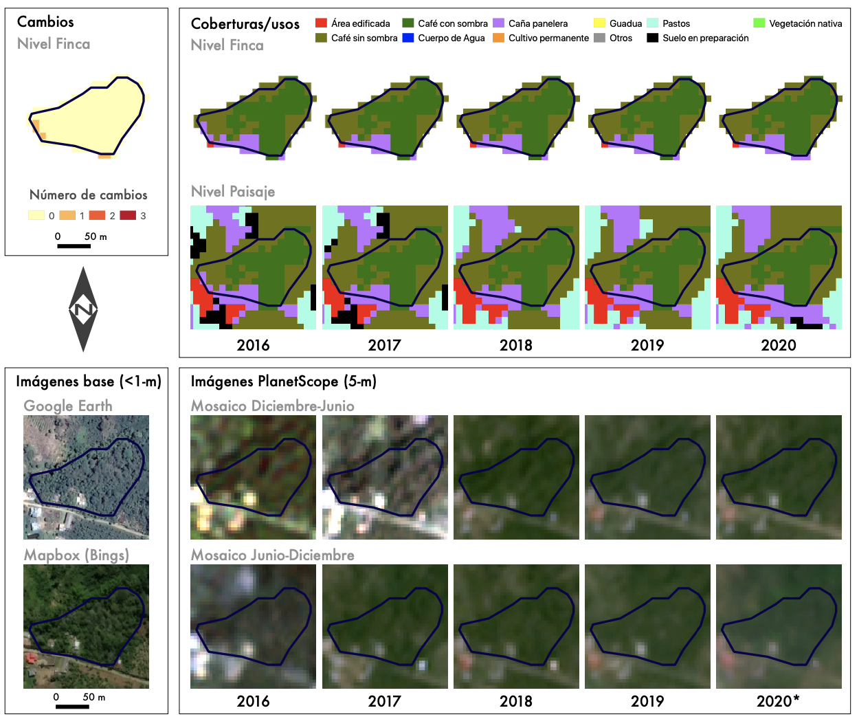
A methodology for mapping coffee production systems using openly accessible satellite imagery, developed through GeoMagic Labs for Solidaridad Network.
Used machine learning methods to process Sentinel 2 and Sentinel 1 imagery in Google Earth Engine to map coffee production systems in Colombia.
CGIAR
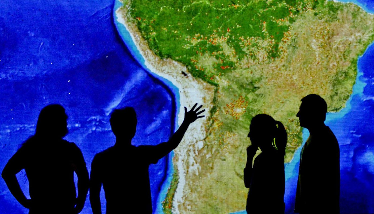
Global habitat-loss monitoring providing free and open deforestation alerts. Quantifying the state of ecosystems across Latin America and forecasting the impact of road infrastructure.
Worked on data acquisition, preprocessing and post-processing of MODIS imagery to generate Terra-i deforestation alerts in near real-time.
WWF
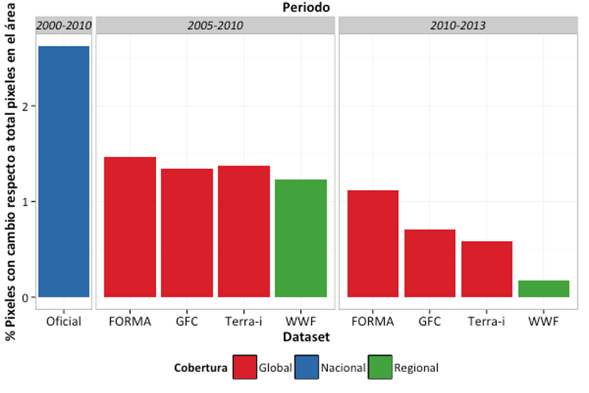
Produced a data quality and accuracy assessment of a WWF MODIS-based deforestation product in the Amazon basin.
Government
Instituto Geografico Agustin Codazzi (IGAC)
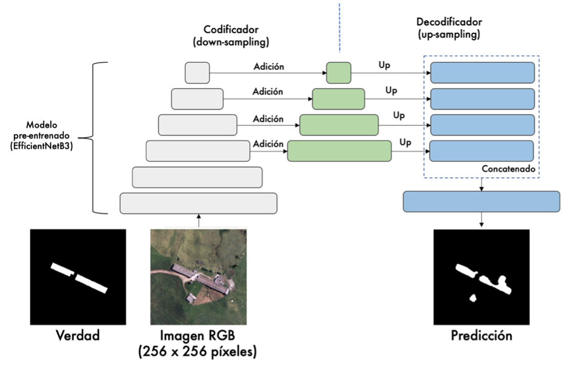
Data-science and artificial-intelligence technologies for mapping buildings in rural settings.
Technical lead on building change detection using deep learning from very-high resolution satellite imagery.
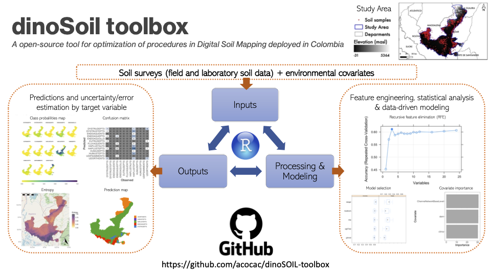
Digital soil-mapping methodologies with data science.
Technical lead on dinoSOIL, a framework in R for digital soil mapping using machine learning and geostatistics.
Ministry of Information and Communication Technologies (MinTIC)
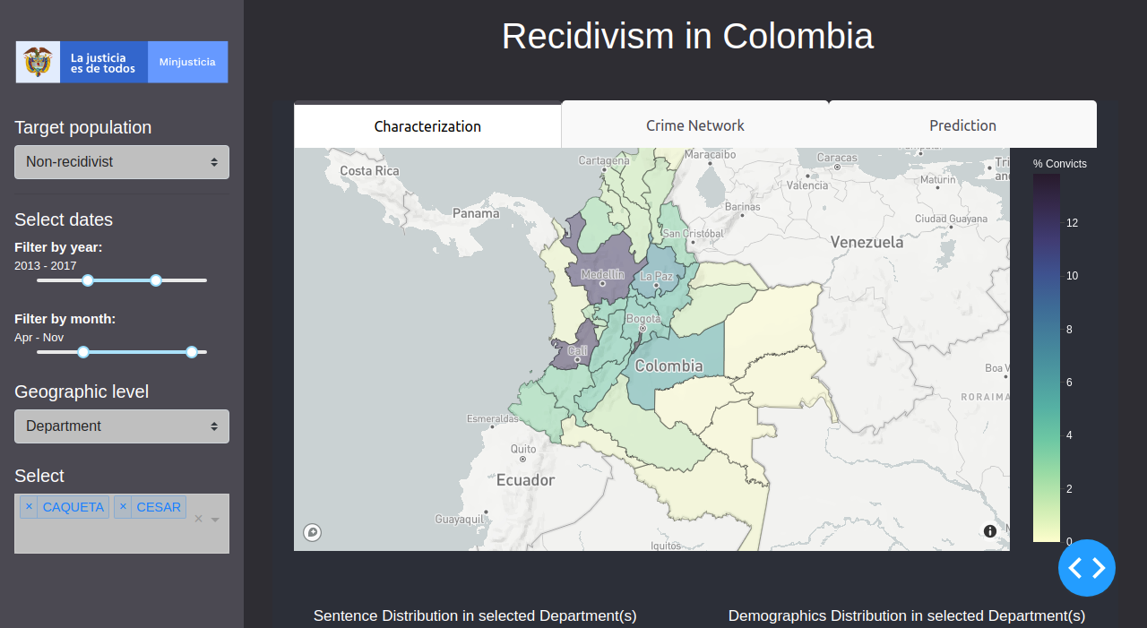
Models and a data dashboard to predict recidivism in the Colombian penal system. Final project of the Data Science for All (DS4A) Colombia programme, Team 60.
Developed a platform in Dash to predict recidivism in Colombia.
Academia
King’s College London
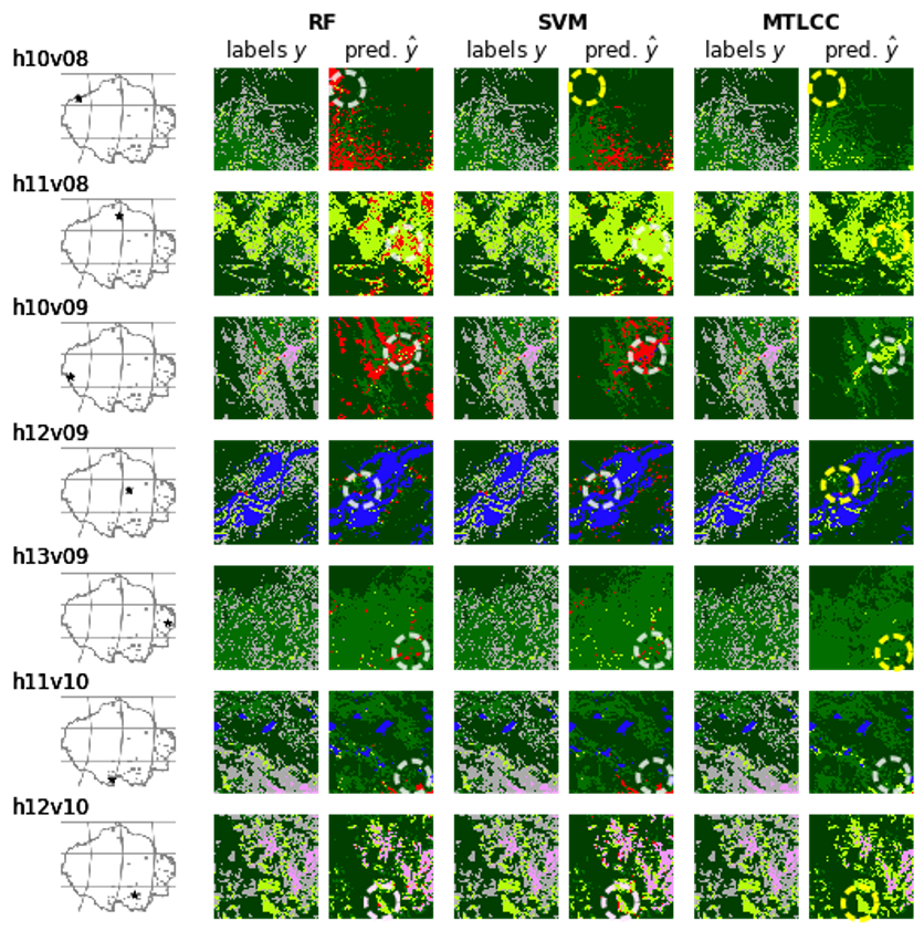
Application of convolutional recurrent neural networks to classify MODIS image time series, extracting information on land cover and land use following deforestation.
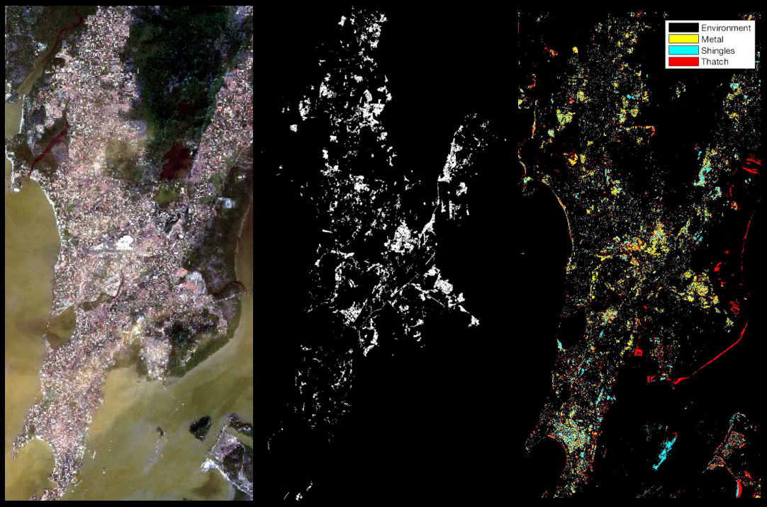
Mapping informal settlements from medium-resolution (Sentinel-2) and very-high-resolution (WorldView-4) imagery at the Frontier Development Lab accelerator (Satellite Applications Catapult, Harwell).
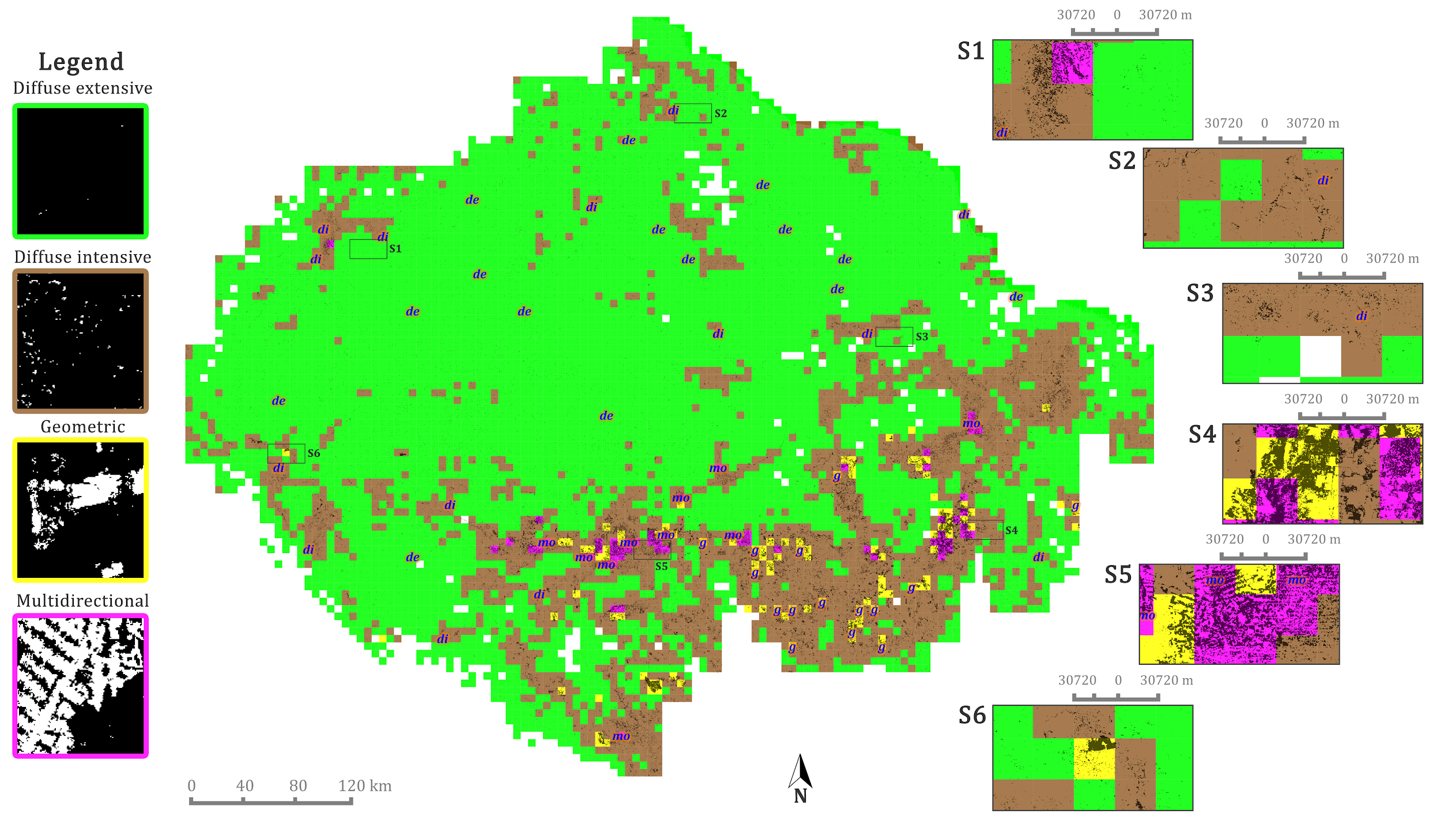
Analysis of the spatial patterns of deforestation using data mining and fractal analysis, drawing on open data from Terra-i and Global Forest Change.
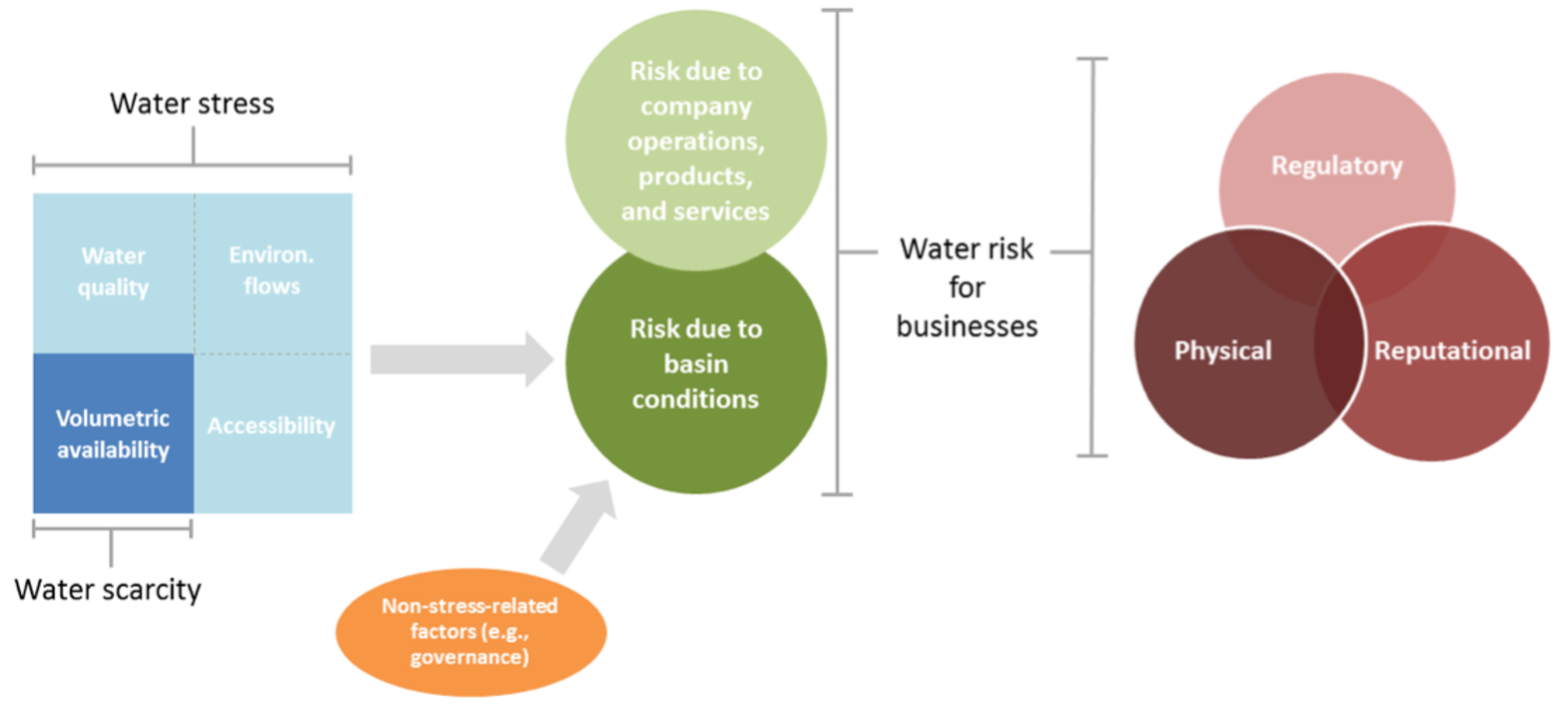
Analysis of water security in the Amazon for Global Canopy (Oxford, UK) during a placement in my MSc at King’s College London.
Universidad Nacional de Colombia
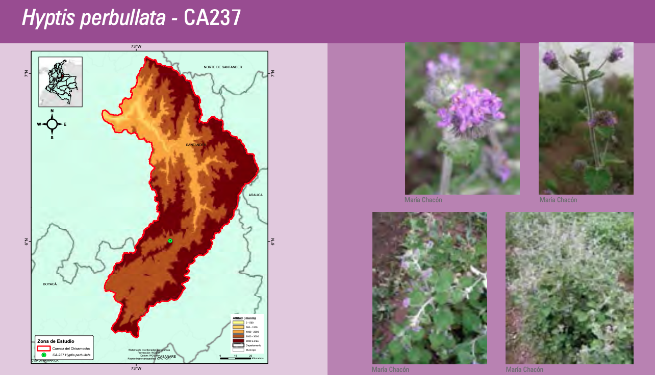
Database and cartography for a catalogue of medicinal plants in Colombia (my first consultancy, 2011).